Showing posts with label soil scientist. Show all posts

Monday, March 05, 2007

GeoAgro soil data collector


I just got back from the 20th Annual Meeting of the NSCSS in San Antonio, TX. Ed DiPollina, TekConsultants, was one of the presenters, and I was very impressed with the potential for a product his company is bringing to market, the GeoAgro Soil Data Collector. Designed for field soil scientists like myself, the Soil Data Collector helps us log soil profile descriptions and geo-reference our field notations, map features & test pit locations in the field on a Tablet PC.

I saw many NSCSS soil scientists sign on as beta testers. Considering the varied applications that field soils data is applied to, this is surely going to be an interesting process.

Similar field data solutions are available to government soil scientists (Pedon PC software was presented to us by USDA-NRCS in San Antonio), but the GeoAgro Soil Data Collector is the first one geared to consulting field soil scientists, arguably a larger and faster growing market than represented by government soil scientists.

It struck me during Ed DiPollina's presentation that the GIS and GPS portion of these types of products is becoming more of a commodity, with the forms and data entry portion holding the interest of the San Antonio audience.

Unlike similar solutions geared to institutional needs, this product will be affordable for the small business to enter into. This is not always a given since GIS solutions vary wildly in price relative to the value provided. If you are already using a GIS product like ESRI's ArcView (ESRI is the world leader in GIS software), no problem, the Soil Data Collector has the ability to export and import different types of files, such as shape, drawing and spreadsheet formats, along with substantial GIS functionality. Don't already have a GIS solution? A simplified non-ESRI solution is being provided.

Speaking of ESRI, affordable alternatives to ESRI products are on the rise. If you are already a locked into being a customer of ESRI, or you are a status quo driven public institution, this will not matter to you. A growing number of us are not. We constitute a market that ESRI has pointedly chosen, through proprietary file formatting and opportunistic pricing, not to serve. I don't fault ESRI for choosing a captive market business model. Its a legit choice. Unfortunately for ESRI, and ultimately ESRI's customers, it is difficult model to adapt to changing market conditions. If the monopolistic aspects of ESRI have escaped you, consider. GIS solutions are simple, ubiquitous, data processing solutions for publicly available georeferenced data. The algorithms used to project the data into only 2 dimensions were constructed long ago by federal agencies using public funds. The math and the data are both freely available to everyone. ESRI doesn't add value to data in the classic meaning of value, it locks it into a proprietary format and holds it for ransom.

A captive market business model smothers the necessity to innovate. Over at competitor Manifold System GIS, several sub$1K solutions are optimized for multiple core CPUs and 64 bit processing. This has been available since August, 2006. ESRI has yet to announce when they intend to provide multi-core or 64 bit functionality, even at the >$120K level. Some generally similar observations about ESRI: (1) (2) (3)

ESRI's loosening grip on the lead and a general increase in GIS software choice and capability are helping to bring innovators like TekConsultants onto the playing field.


Technorati Tags:

Wednesday, January 10, 2007

My 2007 Field Season Begins

This week I field validated my hyporheic confinement hypothesis for a site I have been working on.

I had been out mapping wetlands and characterizing a system of ditches and stream-like features. Lucky for me, a chinook was blowing: soil thawed sufficiently to be observed each afternoon. With not-normal effects on vegetation and soil chemistry from seasonal saturation by a nearby irrigation ditch, I suspect these two particular wetlands would delineate smaller, jurisdictionally speaking, come the growing season in March. But I don't know for certain. The combination of river and irrigation induced hydrology can be confounding.

Many of the stream-like ditches used at the site to accommodate irrigation water and return flows were dry. For the ones that had flow I had a devil of a time getting into them safely to measure their cross sectional profile. Prior to my client's purchase for a residential/golf course project, the property was used to run a cow/calf operation. Much of the lower ditch (15 - 30 feet across) has 20 plus inches of anaerobic mud and manure, a sure recipe for disaster for the hip wader approach. The occasional gravel bar saved me from having to pontoon for my data.

The ditches are running with mostly hyporheic/phreatic Yakima River water. I say mostly, because some snowmelt was running in a small ditch onto the site from the upland terrace onto the floodplain. The Yakima is 1000 feet away and was running near bank-full. The ditches are running a few inches below the ordinary high water scour line, and I feel certain the two hydrologies are connected.


The concept that hyporheic/phreatic hydrology can reach this far is a challenge for most folks, including my fellow project team members. How can river groundwater hydrology be feeding it when the ditch is higher than the river? The answer lies in subsurface gravel filled channels. Rivers lose and gain the same water repeatedly. In losing reaches, water drops out of the bottom into permeable gravel filled channels. Where these channels are covered with less permeable material, confinement can result in a considerable buildup of gravitational head. Where the gravel channel reaches to the margin of the floodplain, confined water can upwell at considerable distance from the river, and can be confused with irrigation derived groundwater.

In the Yakima Valley, with its 500,000 irrigated acres and its network of leaky canals, irrigation induced seasonal wetlands are common. In the floodplain, upwelling hyporheic/phreatic river water can be masked by irrigation induced hydrology, but only while the canals are full, or recently so. During this January visit, long after irrigation diversions have ceased, there was no mistaking the dominant river-induced hydrology at the site. Especially telling was the water level in an existing stream-like ditch compared with the newly constructed closed ditch intended become its replacement. Closed at the upper end, the upwelling river derived groundwater flowing in the new ditch was higher by 14 inches than the water flowing in the adjacent, topographically upgradient, closer-to-canal, older, connected, irrigation district return flow structure. 14 inches is also consistent with seepage on the bank of the older ditch structure. In the photo these are separated by only 60 feet.

These 2 ditches provide the strongest validation I've seen in the 20 years I have been observing and puzzling over hyporheic confinement and upwelling.


Thursday, January 04, 2007

Sombroek's Challenge - Terra Preta Nova

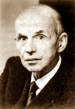
The Godfather of Terra Preta, soil scientist Wim Sombroek (1934 - 2003) enjoyed a lifelong fascination with enhanced soil. The importance of plaggen soil in his native Netherlands impressed him at an early age, and early in the 1960's, he recognized in the Amazonian Dark Earths something familiar and precious. Before his passing, he assembled specific soil scientists, challenging them to discover the process for making and sustaining a modern equivalent of the bio-char enhanced terra preta, what he termed terra preta nova.

A great opportunity in answering Sombroek's challenge lies is surmounting the opacity of mutualistic rhizospheric species to traditional analytical approaches: only 1% of rhizospheric species are cultureable ala petri dish. We don't have a robust body of culture-independent studies against which to compare Terra Preta, so we are doubly challenged to reverse-engineer the phenomenon.

Considering Wim Somboek's many noteworthy accomplishments, the perspective of his international leadership, and the late-in-life timing of his challenge, one senses he is pointing us to a mystery fundamental to understanding soil in new and exciting ways. This happens at a time when the soil science profession is in dynamic transition and sorely in need of a unifying vision. Wim Sombroek has given soil scientists a most welcome and worthy quest.


Saturday, December 23, 2006

George Demas - In Memoriam

Soil scientist George Demas (28 April 1958 - 23 December 1999) pioneered the study and classification of subaqueous soil. He passed away on this day seven years ago. His award winning work advanced the understanding of soil genesis and morphology sufficiently that USDA soil taxonomy required revision. George Demas' death occurred shortly after the importance of subaqueous soil became accepted. His sudden and untimely passing is a great loss to his family of colleagues and friends.

See also: George Demas Elected as Honorary Member of MAPSS, and Wikipedia Article.


Tech Tags:

Saturday, December 09, 2006

GeoCorp America Soil Science Internships


GeoCorps America has announced that 40 jobs will be available this summer, 2007, for work with the National Park Service, US Forest Service, and Bureau of Land Management. These are paid geoscience positions at many interesting locations. GeoCorps Positions pay a $2,500 stipend for 10-12 weeks of duty and free housing is provided. The positions are open to students, teachers, professionals and retirees. Of the 40 jobs, two are soil scientist positions and I would characterise both as college internships. One is in the BLM Butte Falls Resource Area (out of Medford, OR), assessing trail conditions on hiking trails and assessing impacts from off-highway vehicle use. The other is in the Sierra National Forest (out of Clovis, CA) and involves sampling and monitoring under the supervision of the Forest Soil Scientist. Expectations of the candidates for the second one are a tad more demanding. Classwork in pedology, edaphology, geology, ecology and botany is a plus. Application postmark deadline is Friday, 2 February, 2007.

Source post: Geology News.

Saturday, March 25, 2006

Missoula Soil Science Consultant Speaks

Tell someone you are a soil scientist and it invariably requires an explanation of what you do. It's interesting that few of us do the same things and the telling of it reveals much about the person as well as the community they serve. For that reason I like to collect other folks' descriptions of their work. Certainly the telling of Barry Dutton's life work stands among my favorites because he built his business from scratch in a particularly cost-conscious region. He did it largely without the benefit of the 2 main drivers of regional soil consulting booms: booming suburban sprawl and booming energy prices driving increased well drilling and surface mining for coal and oil shale. I've heard several iterations of Barry's telling over the years and look forward to future installments.

Barry Dutton consults out of Missoula, Montana for PBS&J which purchased his company last year. Barry addressed the June 14, 2004 National Cooperative Soil Survey Western Regional Conference in Jackson, Wyoming (pdf source):

I was asked to review what private soil scientists are up to these days and will use my own company to illustrate. I started Land and Water Consulting Inc. 25 years ago and now have 50 employees and five offices. Our staff includes soil scientists, hydrologists, botanists, wetland scientists, biologists, water rights specialists, engineers, surveyors, GIS specialists, technicians and support staff. Our wetland projects this year include wetland delineation on over 10,000 acres. We will restore over 60 wetlands impacted by ski area and golf course development. We will design several dozen wetland mitigation projects and will monitor over 100 wetland projects constructed as mitigation for highway project impacts.

Our vegetation projects this year include several thousand acres of vegetation mapping for EIS studies, vegetation management plans for ski areas, and vegetation TES inventories for project sites. We will also conduct weed and riparian area inventories on private, state, and federal lands.

Our streambank and shoreline projects include restoration along hundred of miles of streams and lakes. We are working on removing a 100 year old dam on a large river within the largest superfund site in the country. This work includes channel design, wetland rehabilitation and riparian area enhancement. We will also conduct watershed analyses and implement TMDLs (Total Maximum Daily Loads) for dozens of streams.

I do a lot of expert witness work and soil survey often has a role in the cases. My oldest case has been going on for over 30 years and the focus is the definition of Peat. The 1911 Soil Survey got it right in describing the site as “high organic content silt loam.” However, the 1959 soil survey called the site peat. The owner sold the “peat” and has been arguing over the definition of peat ever since with the peat miner who purchased it. In another expert witness case, a friendly NRCS soil scientist tried to do a county planner and a developer a favor and produce a wetland map. Unfortunately this person had insufficient training in wetland delineation. The developer filled up to the wetland line and built a parking area before the ---- hit the fan. He spent $250,000 on lawyers, experts, fines and restoration activities to correct his mistakes and is now considering sending NRCS the bill. I am also involved each year in a half-dozen wet basement lawsuits and in almost every case there is a soil survey covering the site that predicted the problem if anyone had known or taken the time to look.

We are also involved in numerous reclamation projects for mine sites, pipelines and other projects. If you want to evaluate soil survey accuracy there is nothing like a 300 milelong pipeline trench across the landscape.

Likely because a longer litany wouldn't add any value, Barry didn't mention several other areas: his extensive work with water use efficiency for irrigation districts, his work instructing health district personnel on soil features relevant to septic systems and his work mapping soils but using project specific approaches that describing would only have distracted NCSS audience from his core message:

The decline of the soil survey program is leading the decline of the soil survey profession.

This is a powerful statement to lay on NCSS, the keepers of the national soil survey program. I plan on discussing it further.

Barry Dutton's message is also at the core of the brand of concern for soil science survival that I was dismissive of at the end of my previous post, a position based on observing the ever increasing demand for consulting soil scientists. Speak with Barry, as I did this afternoon, and you will find his concern is not waning despite his considerable business success and despite the high demand for his individual services. I am reevaluating my position and will present it in a future post. Certainly we soil scientists have the work but without academe, without soil survey sufficient to maintain our critical mass, won't what we do continue to be parceled out among the other disciplines? Any comments on this issue would be most appreciated.


Monday, February 06, 2006

Hans Jenny's Birthday

Tomorrow, February 7th, is the birthday of Hans Jenny. An amazing man, his simple observations often inspired deep insights in his friends. I recently came across an 1984 interview with Hans Jenny and highly recommend it to you. Here is an excerpt:

Soil appeals to my senses. I like to dig in it and work it with my hands. I enjoy doing the soil texture feel test with my fingers or kneading a clay soil, which is a short step from ceramics or sculpture. Soil has a pleasant smell. I like to sit on the bare, sun-drenched ground and take in the fragrance of the soil. ...Soil profile art...resembles abstract art. ...Soil speaks to us through the colors and sculptures of its profile, thereby revealing its personality; we acknowledge it by giving the soil a name.
From: Jenny, Hans and Kevin Stuart, "My Friend, the Soil", Journal of Soil and Water Conservation, May-June, 1984, pp. 158-161.

Tech Tags:

Thursday, January 05, 2006

Retirement of Gary Muckel

Access to data. Access to standards. Access to continuing education. Soil consultants need all three to thrive professionally. The reciprocal is that the profession needs the participation of consultants to thrive. This is less of a disconnect than in 1992, when Gary Muckel began in his efforts to bring soil science consultants in closer with the efforts and products of the National Cooperative Soil Survey (NCSS). Gary retires today. He will be missed.

Just a quick note to pass along the attached notice of Gary Muckel's retirement. Gary has been a wonderful facilitator to us via his NRCS NCSS position in Lincoln -- he has always gone out of his way to forward us publications and other helpful resources and information.

Gary B. Muckel, soil scientist at the National Soil Survey Center in Lincoln, Nebraska, is retiring January 3, 2006, following a 35-year career with the Soil Conservation Service/ Natural Resources Conservation Service (SCS/NRCS).

Gary is a native of California but grew up in Reno, Nevada. He received his bachelor of science degree in plant science and his master of science degree in soil science at the University of Nevada, Reno. Gary began his SCS career in Burley, Idaho, in November 1970 as a field soil scientist. In 1974, he became the soil survey party leader in Twin Falls, Idaho.

In 1977, Gary moved on to Bismarck, North Dakota, as the soil correlator. He later became the assistant state soil scientist in North Dakota. His next stop was in 1980 at Albuquerque, New Mexico, where he served as the state soil scientist. In 1988, Gary joined the West National Technical Center in Portland, Oregon, as the head of the soils staff. It was during this time that Gary initiated activities for the National Soil Survey Centennial.

In 1992, Gary joined the National Soil Survey Center with primary responsibility for the National Soil Survey Handbook. He chaired the Soil Survey Centennial in 1999, during which time more than 1,000 projects were completed nationwide. Gary initiated the Soil Quality Information Sheets and has published more than 50 articles on soil survey. He recently released the publication “Using Soil Survey to Identify Risks and Hazards to Human Life and Property.� Gary has managed the national soils website at http://soils.usda.gov for many years, as both content manager and webmaster. As national marketing coordinator for soil survey for several years, he successfully established a marketing plan for the National Cooperative Soil Survey program. Gary developed and authored soil education CDs and soil profile cards that are used by thousands of schools. He is a member of the Soil and Water Conservation Society and the Nebraska Society of Professional Soil Scientists.

The above was passed along through PSSAC (Thanks, Mary!).

As we in Washington gear up for the next stage in pursuing state licensing of soil scientists, no doubt we will be dusting off Gary's "Understanding Soil Risks and Hazards", mentioned above. I have a link for downloading it below.

Understanding Soil Risk and Hazards: Using Soil to Identify Areas with Risks and Hazards to Human Life and Property. Gary B. Muckel, editor. 2004. 93 pp. Available free online from the U.S. Department of Agriculture, Natural Resources Conservation Service, National Soil Survey Center, 100 Centennial Mall North, Room 152, Lincoln, NE 68508; (402) 437-5499; ftp://ftp-fc.sc.egov.usda.gov/NSSC/Soil_Risks/risks_print_version.pdf.

By drawing on local knowledge and experience, this publication aims to expand awareness of various soil risks and hazards to human life and property and encourage city and county officials, planners, developers, and others to consider the soil in their land use decisions.


Technorati Tags:

In 1794

On January 4th in 1794, was born Edward Ruffin the father of soil chemistry in the U.S., who showed how to restore fertility to depleted soil. Though without formal science education, Ruffin determined that the soil of southeast plantations that had been overused with single-crop production had become more acidic and unable to benefit from fertilizers. The remedy he published (1818) was the spreading of marl to neutralize the acidity. He went further by specifying effective methods of fertilizing, plowing and rotating crops to increase production of grains. He expanded his recommendations in book and journal article form, as well as lecturing up to the 1850's. He then became an outspoken secessionist, and took his own life upon the South losing in the Civil War, at least when he learned of it on June 18, 1865.

Today in Science History

Adapted from a post at XDA blog by Roger Fraley.

This would be a good addition to soil science articles in wikipedia.

Technorati Tags:

Tuesday, December 27, 2005

In Praise of Richmond Bartlett

“We all should fall upon our knees and sing out praise for manganese.�
Richmond Bartlett (wikiquote)

I received the following from Paul Bloom earlier today.

Below is an announcement supplied by Don Ross of the University of Vermont. I truly enjoyed the times I got to sit and discuss life and science with Rich. He was as unique character, but more that he was a good scientist and a fine human being.

Paul Bloom

Richmond Bartlett died Tuesday, December 20 at the age of 78. His contributions to the field of soil chemistry were many and he will be missed. He would surely want everyone to remember the difference between soil and dirt, and the fact that manganese can explain everything (almost). There are plans for a memorial service on Saturday January 7th on the campus of the University of Vermont in Burlington, time and place to be announced.


Technorati Tags: